
Is it worth including?
Vrbas edge · central walking area It fits naturally into a visit to this part of the destination.
- Allow
- Allow 1–1.5 hours for the fortress and river edge, or longer if you are attending a separately scheduled cultural event.
- Getting there
- Kastel is in central Banja Luka beside the Vrbas and fits naturally into a walking circuit from the pedestrian center.
- Ground / accessibility
- Large parts of the site are open-air, but historic paving, wall areas and changing restoration zones can create uneven or stepped routes. Confirm the current accessible entrance if needed.
Understanding Kastel Fortress
Kastel occupies the historic core of Banja Luka beside the Vrbas. City history material connects the site to the Roman road network and a military settlement known as Castra, while the city’s visitor pages call Kastel its oldest historical monument and the place where the earliest traces of settlement in the urban area were found. The visible fortress is therefore the product of a strategic river location used and reshaped across many periods rather than the remains of a single construction campaign.
The fortress has continued to change in the present century. Banja Luka has used Kastel for cultural events while carrying out conservation and adaptation work. In 2026 the city reported completion of restoration on two towers, illumination of the walls and improvements to the Vrbas promenade, with further work planned in parts of the complex. That active restoration is a reason to read current access on the day instead of treating an old map as permanent.
What to see, and what deserves a closer look
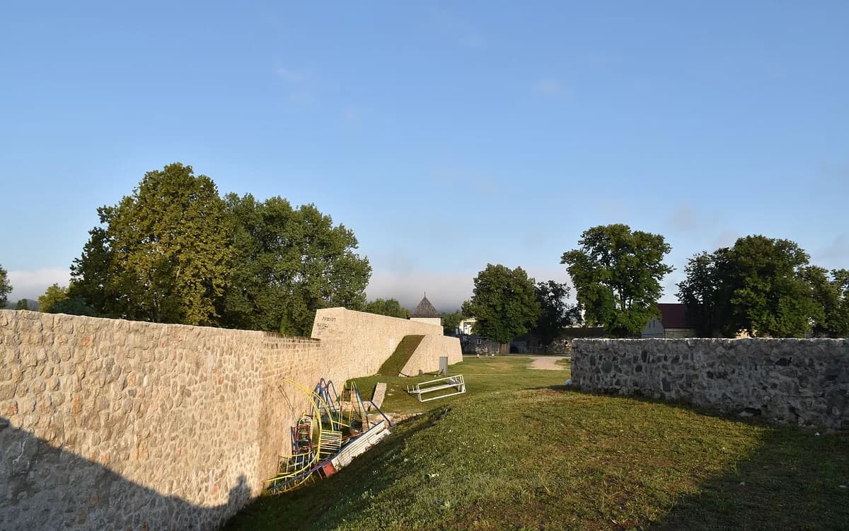
Walk both the interior/wall zone and the river edge. From inside, Kastel reads as a large fortified enclosure; from the Vrbas side, its strategic position and relationship to the city become much clearer.
Use the visit to connect Banja Luka’s central attractions rather than isolating the fortress. Ferhadija Mosque and the pedestrian center are close enough that the contrast between Ottoman, later civic and riverfront layers becomes part of one walking sequence.
Look for these details
- The fortress walls and towers at the Vrbas edge.
- The site’s layered relationship to Roman-era settlement and later fortified Banja Luka.
- The easy walking connection from Kastel to Ferhadija and the central pedestrian district.

How to plan the visit
Kastel belongs in the same central block as Ferhadija and the Vrbas promenade. A car is unnecessary for the monument itself once you are in central Banja Luka; save road transport for the Vrbas canyon or more distant attractions.
Because conservation and event use can temporarily alter routes through the complex, verify local signs and current city information rather than promising that every tower, interior or event space will be accessible.
Timing & conditions
Daylight is best for understanding the fortification and river setting. Evening illumination can add atmosphere, but it should not replace a daytime look at the structure.
Respectful visiting
Respect fenced restoration areas and event setups, do not climb unprotected walls, and remember that the riverfront is a shared public space rather than an archaeological set.
Avoid these common mistakes
- Photographing the river and leaving without walking through the fortress enclosure.
- Using a fixed old access plan despite ongoing conservation and cultural-event use.
Questions before you go
Is Kastel Fortress far from central Banja Luka?
No. It sits in the central city beside the Vrbas and pairs naturally with Ferhadija Mosque and the pedestrian streets.
Is Kastel only a medieval fortress?
No. The site preserves layers associated with a much longer settlement history, including Roman-era activity, and its present form reflects repeated later adaptation.
Nearby sights and a wider itinerary
Because conservation and event use can temporarily alter routes through the complex, verify local signs and current city information rather than promising that every tower, interior or event space will be accessible.
Sources and further reading
History and visitor context are informed by these references. Geographic point provenance and licensed photo attribution are shown separately above; a Google Maps pin is not a historical source.