
Is it worth including?
Wider Una excursion · not a city-centre walk This is a separate outing outside the compact city walking area.
- Allow
- Allow 2–4 hours in the Martin Brod zone; a full half-day is more realistic once road travel and a slower walk through the settlement are included.
- Getting there
- Martin Brod is a separate road-based southern park destination, not part of central Bihać. Follow National Park Una’s current access guidance.
- Ground / accessibility
- Natural river paths, village surfaces and viewpoint approaches vary. Visitors with limited mobility should ask the park which current viewpoints can be reached with the least gradient or uneven ground.
Understanding Martin Brod & the Una cascades
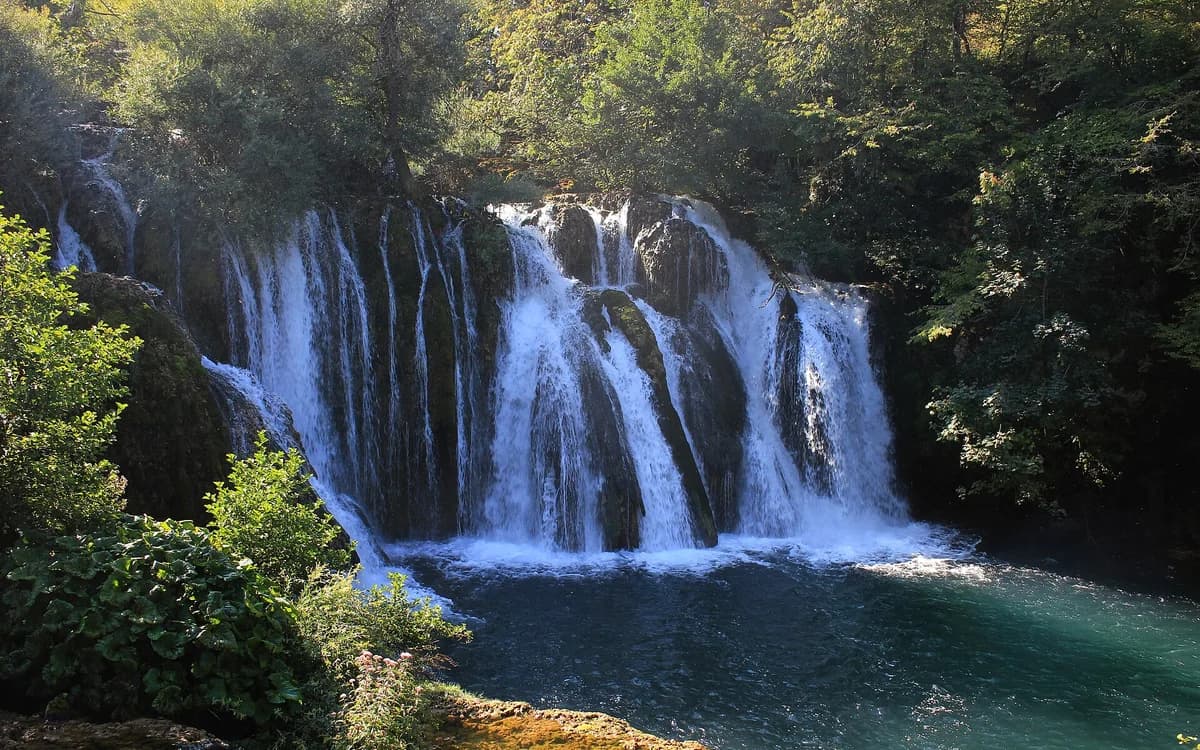
Martin Brod is a southern Una National Park visitor zone where river cascades, settlement and cultural heritage overlap. Unlike a single-monument attraction, the experience is tied to the way the Una moves through and around a lived-in place. National Park excursion material treats Martin Brod as its own destination area, and the protected landscape also includes the nearby Rmanj monastery as part of the broader cultural context.
The waterfall system around Martin Brod is often described through Milančev buk and a series of smaller cascades, but the larger historical point is that people have lived with and used the river here for generations. Mills, crossings, settlement patterns and religious heritage belong to the same landscape. That makes Martin Brod a slower park day than Štrbački buk, with more value in moving between natural and cultural points rather than concentrating on one dramatic overlook.
What to see, and what deserves a closer look
Walk the visitor area as a sequence: water first catches attention, but lanes, river channels and the settlement keep changing the scale of the visit. Give yourself time to hear and see the smaller cascades instead of searching only for the largest fall.
If current access allows, add the Rmanj monastery area as context rather than as a rushed extra. The combination makes clear why Martin Brod is a cultural landscape as well as a waterfall stop.
Look for these details
- The layered waterfall and cascade landscape around the Una.
- The interaction between river scenery and the small settlement rather than a single fenced attraction.
- The wider cultural context that includes Rmanj monastery and long-standing human use of the river valley.

How to plan the visit
Martin Brod is deep enough in the wider Una geography that it deserves a substantial daylight block. It works well as the primary objective of a park day from Bihać or as part of a stay closer to the southern park zone.
Use official park information for road access and visitor rules. Do not build the schedule around an old drive-time estimate or assume that every river path and activity remains available under all water or weather conditions.
Timing & conditions
Use daylight and keep road margin, especially if Martin Brod is one leg of a longer northwest Bosnia route. Re-check park notices rather than relying on a fixed seasonal schedule.
Respectful visiting
Respect both protected nature and a lived-in settlement: stay on accepted routes, keep noise low near religious sites and homes, and do not enter private riverside land for a better photograph.
Avoid these common mistakes
- Expecting Martin Brod to feel like a second version of Štrbački buk; its strength is the slower mix of settlement, heritage and water.
- Planning both major Una waterfall zones as hurried photo stops on the same long transit day.
Questions before you go
What is the difference between Martin Brod and Štrbački buk?
Štrbački buk is the more concentrated signature-waterfall experience; Martin Brod is a broader southern park zone where cascades, settlement and cultural heritage combine.
Should you stay in Bihać to visit Martin Brod?
Bihać is a practical service base, but Martin Brod requires a separate road journey. A park-side or southern-zone stay can make sense if this part of Una is your main priority.
Nearby sights and a wider itinerary
Use official park information for road access and visitor rules. Do not build the schedule around an old drive-time estimate or assume that every river path and activity remains available under all water or weather conditions.

Sources and further reading
History and visitor context are informed by these references. Geographic point provenance and licensed photo attribution are shown separately above; a Google Maps pin is not a historical source.